An Olympic Coast Getaway
 I ran along the gentle singletrack trail.
Some sections were long stretches of boardwalk. I cruised along easily, Lisa
and her husband Jason were behind me. I could hear the ocean as we got closer.
The forest was thick with underbrush and packed with trees, a temperate
rainforest along the upper Washington Coast, in the Olympic National Park.
Salal, sword ferns, evergreen huckleberries, small hemlocks and other
vegetation grew thick alongside the trail. There was a light drizzle. The air
was pungent with the smells of the ocean and its shore. The temperature was just about perfect for
running in short sleeves and tights. The breeze off the sea was not too cold,
as we approached it now, about mid-day.
I had gotten off
work about 3:30 on Friday afternoon and headed straight for the Coupeville
ferry that crosses over to Pt. Townsend. From there, it would take about 3 ½
hours to reach Ozette Lake, the 3rd largest natural lake in
Washington. This is where Lisa and I would begin our Coastal Adventure. We had
initially planned on running the UltraPedestrian Wilderness Challenge Coastal
Route, designed by Heather “Anish” Anderson for the 2014 UPWC. As we both
researched the route, it became clear that November was not a good time to try
it, especially since the Super Moon was creating extra high tides and Stormageddon
in October had washed out roads throughout the park. Long stretches of muddy
trail, high water levels for river and creek crossings, and the times for low
tide (4:00 a.m. and 10:00 p.m.) also made for dicey planning. We decided to
meet at Lake Ozette instead, and approach the coast from there. There are two
trails that lead to the ocean from Lake Ozette, each of them three miles in
length. At low tide, a triangle loop of nine miles can be formed by running to
the ocean via either the Cape Alava Trail or the trail to Sandy Point, and then
connecting the two of them by running three miles along the beach.
I arrived at Lake
Ozette at nearly 11:00 p.m. It was pouring down rain as I pulled up to the
campground and parked in the camping space behind Lisa and Jason in their Palomino
camper. I would make a spot to sleep in the back of my Suzuki in order to stay
warm and dry from the rain. But first, Lisa and I took her dog Lucy on a long
midnight walk under umbrellas along the lonely road that runs beside Lake
Ozette. It felt so good after a long drive to get out in the rain for a nice
walk. The air smelled so fresh. At times, wind gusts came up so strongly that
we had to put away the umbrellas. We made our plans for the next day as we
hiked along, excited about spending a long day on the trails together.
I slept soundly,
then awoke and shared coffee with Lisa and Jason. He would join us for the
first part of our run and then spend the rest of the time with Lucy at their
camper. Lucy was not allowed on the trails since it was a national park. We
decided to first run down to the ocean on the Sandy Point Trail. Lisa and I generally run and ski in the
mountains together. This would be our first adventure at the ocean. Lisa and
Jason live in the Okanogan Highlands of north central Washington and were
spending a two week vacation on the Olympic Peninsula. During the summer, we
had planned on running the Coastal Route while they were in this neck of the
woods on their vacation. Now, together in the enchanting rainforest, our
earlier plans were coming to fruition.
The trail was relaxingly gentle. I had
anticipated the boardwalk stretches to be slippery and the going slow, and at
first it was. But as I ran peacefully along the smooth singletrack, I
transitioned onto the
boardwalk stretches with the same gait, using just a bit more caution.
It was a lot of fun and the miles cruised by easily. Running at sea level has its advantages. It is
much easier to keep a gentle breathing pattern compared to running trails in
the higher elevations of the mountainous terrain. I was definitely enjoying
this coastal run.
We snacked on
evergreen huckleberries that were loaded on bushes alongside the trail and
boardwalk. They were delicious and their flavored had a hint of ocean
flavoring, almost like seaweed. I had never had this wild berry and it was fun
to discover another one of nature’s gifts. I imagined the Makah Indians
gathering these berries, one of the mainstays of their diet.
And now, on that
singletrack approach to the coast, I felt a tinge of excitement as the sounds
of the waves grew louder and the smells of the ocean grew stronger. Before I
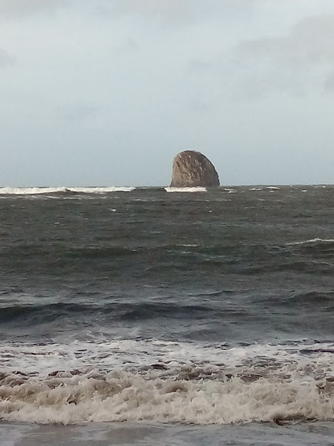
knew it, I could see sea stacks looming out of the ocean waters. The forested
camp that sits just off the shore was a place we could stand for shelter from
the wind while Jason, Lisa and I each took in the view. I was brought to tears
by what I was seeing and feeling from the power of the ocean. A bright red buoy
hung from a broken branch of a fir tree. The wet drizzle shimmered off the
bright green, tall sentinels of the shoreline, the coastline heavily forested
and rugged. I loved being here, in this moment and I was so thankful that I had
all day and into the night to explore as much of this area as I could.
The piled up
driftwood had hidden treasures, both natural and man-made. The tide was in and
so we would have to wait to run the shoreline. We decided to do a short out and
back section that would take us to another spot down the coast and then return
to Lake Ozette while the tide receded. We would take the Cape Alava trail to
get back to the ocean after eating some Thai Peanut Rice Soup I had made to
share, back at our camp at the lake. Jason would stay behind with Lucy while
Lisa and I continued our run. The Super Moon would be shining on us past dark
and would help light our way.
Lisa and I set
out again, this time taking the fork in the trail that led to Cape Alava, north
of where we had hit the shore on our earlier outing. The Pacific Northwest
Trail ends at Cape Alava. There are nice campsites set back in the forest
slightly, all along the shore. During
the warm summer months, these campsites are very popular. But now, in mid-November,
there was almost no one else around. As Lisa and I made our way along the
boardwalk trail out to the coast for the second time that day, we saw a couple
of parties of backpackers hiking back to their cars. It was quiet and serene,
once we got to the beach.
The tide was out
and we were able to hike and run along the shore. It was getting later in the
day and the sun would soon start to set. We had to watch for the sign hanging
from a tree that would indicate the spot where we took the trail back to Lake
Ozette from Sandy Point. It was about three miles from Cape Alava. The scenery
was spectacular in every direction. I enjoyed beachcombing, and picked up some
pretty sea glass, shells and agates. The receding tide left tidal pools with
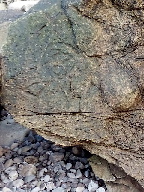
all kinds of sea life in its wake. I wandered through the huge sea stack
formations known as Wedding Rock, and saw the ancient Native American
petroglyphs known to be there. As the
sun set, Lisa and I took a break on a piece of driftwood. We wanted to savor
the moment, looking out to the west where the sun dropped below the horizon,
and where the ocean sprawled as far as the eye could see.
We got to the
sign indicating the overland route that begins at Sandy Point. We got on the
trail here and headed for a primitive four mile out and back trail to a remote
spot on Ozette Lake. Once we got to that trail, we could see how primitive and
unmaintained it actually was. Lisa and I headed up it for a short distance,
realizing that our almost magical time on the beach was much preferred. We
turned around and headed back to the coast. We continued south along the
shoreline, knowing that the tide would come back in at 10:30 p.m. We would have
to watch our time and the incoming tide, and get turned around in time. We needed
to be back to that overland trail to Ozette Lake before the high tide was upon
us, with it’s dangerous rolling logs and incoming waves.
Paying attention
to tides, the boardwalk trails, the evergreen huckleberries and mystical rainforest;
there was so much uniqueness to this run. I highly recommend a trip to these
coastal trails and time spent on the coastal route itself to all hikers and
trail runners. Remaining flexible and being okay with some night time hours on
the trail will help make a long day of it possible.
Lisa and I made
it back to the trail with time to spare. I did not feel spent like I did after
long days on mountain trails. I didn’t even want it to end, although I was
ready for some more of that soup and Lisa’s apple bread. It felt almost as if I
were floating along as I ran back through the rainforest. I trusted my footing
on the boardwalk stretches. I breathed in the fresh, drizzly air. Lisa was
behind me as we ran easily along the twisting and turning trail. We pieced
together twenty miles of sweet trails and coastline. It had been a blast.
Back at our camp,
we set up chairs outside and ate our hot soup in the misty rain. The
temperature was perfect for sitting outside in the dark, feeling good after a
long day of fun exploring. The camp was quiet, most folks tucked away in their
tents or camper vans for the night. The moss draping from the birch trees along
the lake’s shore created a mystical back drop to our camp meal scene. Lisa
fixed us hot tea to sip on while the moon gave us all the light we needed.


This comment has been removed by the author.
ReplyDeleteOh my God! You captured what for me is the most beautiful spot in the world - Cape Alava and the coastal trail down to Mora. My husband and I spent many vacations hiking and beach combing on that stretch. At Cape Alava in the surf just below the small tribal ranger station is the anchor from the shipwreck Austria in 1892? which we searched for several times. Then at a very low tide we found it and walked right up to it and got a photo of Jack with "his" anchor. I returned there in 2010 to place Jack's ashes beside the anchor where he wished to rest forever. Two bald eagles circled the exact spot shortly afterward and I turned Jack's care and vigil over to them in perpetuity. I have lots of photos of the coast, boardwalk trail, the homestead just off-trail, driftwood, crab floats (in fact on my fence in Spokane hang about 30 floats we brought back from our various trips there), and native petrogyphs including a sailing ship carved into the "Wedding Rocks". Tears of sadness flowing, and a smile for the sweet memories on my face.
ReplyDelete