Rim to Rim to Rim to Rim to Rim to Rim to Rim:
2013 Only Known Time #1
First Ever Sextuple Crossing of the Grand Canyon Trip Report
by Ras
I got this Facebook message less than 48 hours before my friend and I were supposed to leave for the Grand Canyon to attempt six consecutive crossings via Bright Angel Canyon, along the South Kaibab Trail and North Kaibab Trail:
"Hey, I may have to cancel/postpone. : ( . On pretty routine run, I rolled my ankle. Its not the worst sprain, but with the task in front of us I dont think it would be wise for me to go until it heals."
When I read those words I had an immediate panic response; my heart rate elevated, blood started rushing in my ears, and the world seemed to kaleidoscope away from me to a distant point, like a portentous hallway elongating before your eyes in a horror film. In an instant months of planning, focus, gear acquisition, scheduling, and mental rehearsal teetered on the brink of collapse.
As is its want, my brain immediately began running through the new logistical challenges that I faced; My car won't make it that far. That's a ton of driving to do solo. What would it cost to rent a car? Can I hop in with someone else already heading to Arizona? I better Google Map the route. Can I drive straight through in one push?
But as I filled Kathy in on this development I felt the resolve coalesce within me. One of my mottos, which has proven itself over and over again, is that stubbornness trumps skill and preparation. My parents must have told me 'no' thousands of times as a child, but I still hate hearing it. Whether it's from a friend, an employer, the government, or the universe itself, 'no' is an answer I am rarely willing to accept. Within myself I said, "Alright, Universe, you're gonna have to do a lot better than that if you wanna stop me."
Running from one rim of the Grand Canyon down, across, and up to the opposite rim, then reversing course back to your starting point is one of the classic test pieces of ultrarunning. Years ago, as a backpacker morphing into a budding trail runner, and still somewhat inexperienced, I marveled at the idea of a single crossing of the Grand Canyon. The idea of a double crossing, the rim to rim to rim as it's known, seemed a superhuman feat belonging to the rarified realm of the elite endurance athlete. I didn't think it was something I could ever do. In fact, I doubted that I would ever even meet someone who could do it. I didn't move in those circles (although now I'm known for moving in circles) and didn't know those people. And I, myself, certainly wasn't one of them. But years later I would come to reevaluate that conclusion.
When I drove into the South Kaibab Trailhead parking lot in my rented Chevy Cruze it was just after 11:00pm Friday night. My original goal had been to start a few hours earlier than this and have an entire crossing completed and much of the return trip before it got light, while it was still cool. But this was beyond even considering at this point. I wandered around a little bit with a headlamp to stretch my legs, then got into the passenger seat, reclined it, set my alarm for 6:00 am, and fell asleep. I knew that a 6:00 am start was by no means considered early for the rim to rim to rim, but I was already mind-numbingly tired from all the windshield time and had no choice but to get some rest before I began.
At this point, what I should have done was just hang out and rest all the next day, sleep as much as possible, and then start in the mid evening, as I had planned, but 24 hours later. But I still thought I could complete the triple-double in about 48 hours and then drive home and be back to work two days later. Fortunately, the friend I've been working with is a runner and is super supportive of my adventures, allowing me lots of flexibility when plans go awry.
My alarm sounded after what seemed like only a few minutes. I was very slow waking up and dragging myself out of the car. It was disheartening to realize that I was already exhausted, and I hadn't even taken my first step yet. But I was here to do this. I busied myself with getting my pack ready, eating and taking my supplements and dressing as I did so.
Just as I was getting ready to put my pack on, a park service employee approached me and asked if I had a backcountry permit. I told him no, as I was just a day hiker. He was really kind and warned me that without a backcountry permit parking pass my car would likely get ticketed, and told me where I could park for free on the shoulder of the road about 1/4 mile away. I thanked him, relocated the car, and hiked back to the trailhead.
I was carrying all of my calories for all six crossings from the start, as well as all of the gear I would need for cold weather and running through the night. My plan was not to access my car or any sort of food cash for the entire 126 miles. To my mind, this was in keeping with the Alpine ethic of completing a route "in good style". That was my goal, first and foremost Speed was at most a tertiary consideration.
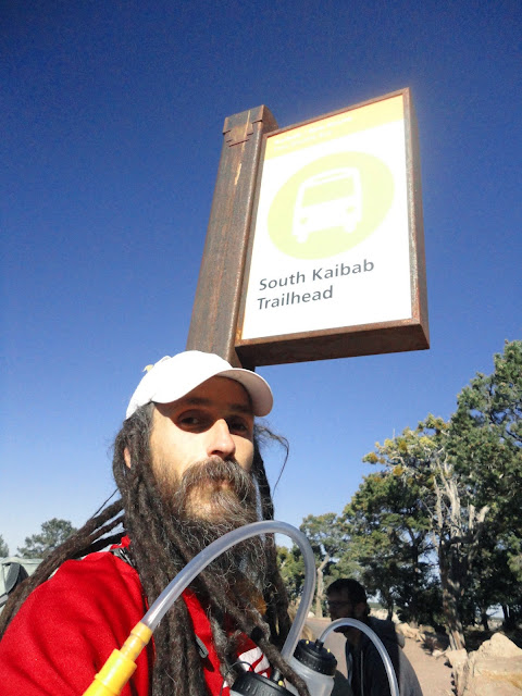
I took a couple of photos, calibrated my altimeter, started my SPOT transponder, wrote my start time on my leg in Sharpie, and dropped in at the top of the South Kaibab Trail, wending my way through the tourists and hikers. It was enjoyable and invigorating to finally be beginning this challenge, but it was also awkward. I had never actually run in my new pack before, and I had not been doing any running in a weighted pack recently. Intellectually I understood the benefits of having most of my heavy food in the front pack to aid my forward lean from the ankles, but translating that into comfortable movement was a less than instantaneous adjustment. I soon conceptualized my front pack as a prosthetic beer belly, and for some reason that made it more manageable mentally.

As my mind was working on these adjustments, my vocal chords were as busy as can be. My entire first descent of the South Kaibab was a ninety minute long mixtape of freestyled warnings, pleasantries, thanks, and well wishes. "On your left! Thanks! Enjoy your trip! On your left! Thank you! Have a great hike! On your left! Oops! Okay, on your right then! No worries! Thank you very much! Have Fun! On your left!" My voice was hoarse by the time I reached the Kaibab bridge over the Colorado River.
During this down run I was actually indulging in such hubris that I began thinking about the possibility of doing a quad-double. After all, I was already at the Grand Canyon and had invested the time and money to get here, and who knew when I might have the chance again? If my legs held out, I thought I might be able to resupply at my car after the third rim to rim to rim, and then just treck out a fourth. This delusion did not last long.

The climb up to the North Rim is 14 miles long and quite gradual for the first 7 miles or so, with some rolling sections. I pulled out my trekking poles and began quickly poling up the inclines, and continued running the flats and brief downhills. Just a couple of miles past Phantom Ranch I met a Park Services employee named Matt coming the other way. He asked me what I was up to and I told him I was on an extended day hike. (This is how I described my trip because I did not have a backcountry permit, as I was not using any camp sites. Rangers on the Wonderland Trail have told me that they consider people running the trail to be dayhikers, so I assumed this applied here as well.)
He gave me a brief, friendly lecture about trail etiquette, asking that I call out ahead of time to hikers and tourists before I pass, so as not to scare them. He also quickly went over Leave No Trace techniques, and I assured him that I was on board with all of that, that it was the only way I traveled trail. I could tell this was a prepared spiel, and deduced that the Park Service was concerned about ultra runners not playing well with others.
He asked me if I was doing the rim to rim to rim, and I admitted that I was attempting the first ever triple rim to rim to rim. I showed him my jars of nut butter, listed off all of my cold weather gear for overnight, and showed him my SPOT transponder. He said, "Okay, so if you get tired you can just lay down on the trail and spoon out some almond butter and nap?" I told him yes, indeed, that was the plan. He told me he would be at Phantom Ranch and to stop in and let him know which crossing I was on if he was around. He was friendly and cool and supportive.
By this point it was 100 degrees in the canyon, and I was really feeling the heat. I would run and treck for a half mile or so, and then find a cool rock in the shade and sit for three minutes or so to allow my core temperature to tick down a few notches. Without fail, each time I would sit down a fresh, perky, and surprisingly clean runner would come around the next corner, making it look easy. I was barely a twelfth of the way into my trip, and I was already struggling a bit. This was indeed going to be epic, where 'epic' means brutally hot, painful, and humbling. Just what I love about ultra running.

I had two Globespun Gourmet Thai Wraps with me that I intended to eat as soon as possible, because they were heavy and could possibly spoil. I like big, long climbs because they give me the opportunity to eat a bunch of solid food and digest while I am climbing. That way it can move further into my digestive tract before I begin down running. I ate my first Thai Wrap and it was delicious.

I leapfrogged from shady rock to shady rock, chatting briefly with other ultra runners as they passed me on their way back to the South Kaibab. I had followed the accepted protocol for Fastest Known Time attempts by posting my intentions all over Facebook and the Fastest Known Time site maintained by Peter Bakwin Fastest Known Time - Grand Canyon, so there were more than a few people who talked to me that knew what I was attempting. It was amazing and intimidating. Knowing that people were paying attention to my attempt added a little bit of pressure and motivation to get the thing done, but I was beginning to have doubts.
Just above Roaring Springs a young woman ran down past me, then two guys running down called out to me, "Hey remember us from White River two years ago?" One of them said, "I just read you blog about the Double Wonderland. Man! That was epic!" Then a realization dawned on him and he asked, "What are you doing here?" I told him and all three of them (the young woman had hiked back up to us) gave me first bumps. I said, "Well, I haven't even done one crossing yet, so it's a bit premature to give me any credit." They pshawed that, offered encouragment, and ran off with the ease of adequately trained athletes performing at a sustainable level. I slogged on.

When I reached the North Rim it was wonderfully cold and breezy. I filled my water and took a proof picture by one of the trailhead signs, and just sat and drank water until I was wonderfully chilled. I was shivering, and my hands were going numb, and it felt wonderful. I knew I would warm up again as soon as I dropped a few hundred feet back into the canyon, so I enjoyed the chill as my core temperature dropped.
I did run fairly well dropping back into the canyon, but was moving a bit slow because of the heat. I made sure to drink all my water when I knew I was nearing the next water source. I was feeling a little shaky, but basically okay as I descended to the heat of the canyon floor.
I found a rain shell someone had dropped just below the North Rim. I put it in my pack and carried it for the rest of the trip. So it became one of only two rain shells to traverse the Grand Canyon six times in a single push.
I really enjoy running through the night solo in part because of the opportunity to see wildlife. Each time I saw eyes reflecting my headlamp in the distance I would pull out my camera in hopes of capturing something exotic. But it was mostly deer bedded down just off the trail. I did get a quick glimpse of a fox, but it was too shy and quick for me to photograph. Bats were constantly swooping into my headlamp beam to catch bugs, which thrilled me.
Then I made an amateurish mistake. At Phantom Ranch I refilled my two 750 ml water bottles, but neglected to fill the one liter collapsible bottle I was carrying. I knew that there was no water for the next seven miles, but had become a little confused. I thought I remembered seeing a bunch of tourists getting water at a spot about 1500 feet below the south rim. But I was wrong.
I ate my other Thai Wrap and washed it down with a generous amount of water. It was incredibly hot considering it was now after dark. And there were brutal winds, with gusts up to 40 mph. A couple of times these gusts caught me off guard and send me stumbling toward the abyss on the downhill side of the trail. From then on I hugged the uphill side of the trail. My eyes and mouth were continuously being filled with grit. I quickly finished the last of my water, under the illusion that I would soon reach a water source.
When I am on long runs like this I like to take micro naps. When my brain gets fuzzy and my thoughts become unclear, I will simply lay down on the side of the trail for a few minutes, then suddenly snap awake surprisingly refreshed. But climbing up the South Kaibab Trail I was seeing lots of scorpions. They were not aggressive, but when they moved they were disconcertingly fast. I couldn't get past the idea that they would climb on my while I was asleep, then sting me when I absent mindedly reached to scratch the tickle of their footsteps. So I would just sit on a rock with my head resting in my hands until I fell over and woke up, then move on again. A few times I found big, flat rocks that were elevated well above the trail tread. I would inspect around the base of these and make sure there were no scorpions lying in wait, then curl up on top of the rock for 5 or 10 blissful minutes of rest.

Not only was I out of water for the last three hours of my first rim to rim to rim, but because of that I couldn't eat. My main fuel source was plain almond butter, and with the horrendous cottonmouth and dry throat I was suffering, there was no way I could choke down nut butter. So for the last 5 miles of my first crossing I had nothing to eat and notheing to drink, and when I finally arrived at the South Kaibab Trailhead, I had been brutalized by the canyon and my own poor planning.
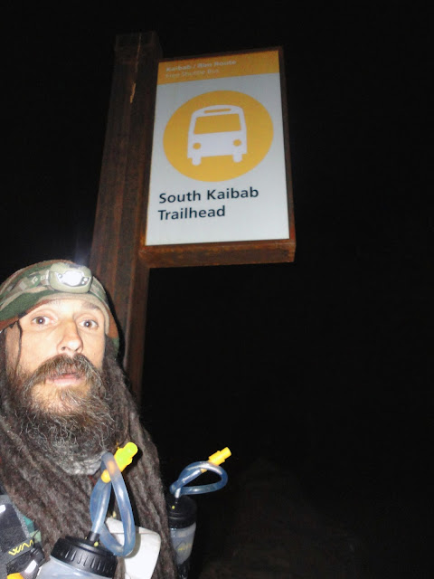
The temperature had dropped considerably as I climbed, but the winds had not abated. As I filled my water bottles I began to shiver violently. I think the self shot photo above aptly portrays my physical and mental state. For the first time ever, I seriously doubted whether I would be able to continue. I didn't seem prudent to drop back into the canyon in the shape I was in. There are signs along the South Kaibab that state the old mountaineering saw in reverse; going down is optional, getting back up is mandatory.
But one of the things I love about crazy distances is that there is time to make mistakes, suffer, then recover and continue on. I was in no hurry. I didn't have to beat anyone's time, I simply had to complete the distance. So I filled all my water containers and barricaded myself in one of the restrooms to escape the wind. I put on all my cold weather gear, a wool shirt, a wool neck gaitor, a puffy down jacket and pants, two hats, and my liner gloves and mitts, and reclined against the wall of the shitter. I drank about three liters of water and ate a bunch of almond butter, coconut butter, crystallized ginger, and dried mango.
After about two hours I felt greatly revivified and decided that it would be safe to continue on with my adventure. I dropped over the rim and began descending the South kaibab Trail for the second time. It felt like dropping into a huge halfpipe that was beyond my skill level, not knowing if I would be able to successfully land my air at the other lip.
It also occured to me that running rim to rim is like the first stages of life. It's easy to attribute archetypal female characteristics to the canyon, considering its basic form. And the quick down run into the canyon struck me as reminiscent of the flagella driven swim that begins each of our lives. The Traverse across the canyon floor is is akin to a gestation. And the exhausting, head crushing climb to the opposite rim has all the strain and trauma of birth. And I was here to repeat this birth ritual six times. Each rim to rim was like an incarnation.

As I neared Roaring Spring on the second double crossing, a young Park Service employee starting running along with me. "You're Jason, aren't you?" he asked, and I confirmed it. He said, "We all think what you're doing is really cool. Some of these runners that come through are kinda (he made a noise implying mild distaste), but you seem like a cool guy." I was flattered and stoked. It was supercool to have all the rangers and Park Service personal being so supportive. It was just one more reason I couldn't give up. We talked about Altra Zero Drop Shoes for a bit, then he took off, breezily floating off ahead of me with effortless form.
Things were going much better now. The second day was cloudy and mild, which was a blessed relief. Another 100 degree day may have been untenable. I seem to be reverse solar powered, and direct sun would have slowed me to a crawl.
I made moderate progress on my fourth crossing, hiking a lot of flat ground that I really should have been running, but continuously moving forward. Another Park Service employee greeted me by name and said she would radio the Phantom Ranch Ranger with an update on my progress. She offered me a couple of Lara bars, which I declined politely. I was again amazed and bouyed by this support and encouragement, and felt unworthy of both the faith placed in me and the opportunity to attempt such a thing.

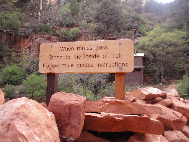
Climbing up the South Kaibab Trail for the second time, this time with my 1 liter bottle full as well as my 2 750 ml bottles, I was overwhelmed by the impact of the mule trains. There were numerous spots on the trail where there were standing puddles of mule piss, with rivulets running out of them down the center of the trail. Most of that 7 mile climb just reeked of mule urine and feces. To a great degree the South Kaibab is a pack trail more so than a hiking trail, and there were constant reminders of this. I couldn't help but dwell on the irony of hikers and runners being asked to use leave no trace techniques on a trail that was little more than a 7 mile long latrine for the beasts of burden of the mule skinners. But admittedly, I was a little cranky at that point.
I reached the South Rim for the second time about 2 hours later than on my first rim to rim to rim. Again I holed up in the restroom to get out of the wind, drank a bunch of water, ate a meal's worth of calories, rested a little, and prepared myself mentally to drop into the canyon again.
This was where it got real. This was uncharted territory. And this was where I love to be. Now I suddenly knew I had it. I only needed to cover 42 more miles, and it didn't matter how slowly I did it. I could just hike the entire thing if that's all the speed I was able to make. And I knew that I could do that no matter what. In humble amazement at the grand scope of human potential, I dropped into the Grand Canyon for my third and final rim to rim to rim.
Again it was blessedly cool. Apparently the canyon had been satisfied after handing my ass to me on the first double. I had been brought down off my high horse, shown my frailty and vulnerability, and then mercifully granted a reprieve. And I was happy to accept. With the canyon's permission, I continued on.
The third day dawned cloudy and cool. It was perfect weather, with brief occasional sun breaks to keep things cheery, but blessed cloud cover that kept the temperatures just on the cool side of perfect. As I climbed up the North Kaibab Trail there were a few brief cloudbursts and a short hailstorm. I got to try the built in pack cover and rain shell included in my new pack, and was pleased that, with a little contorting, I was able to deploy them both without having to remove the pack. Later I was also able to stow them without taking the pack off, just as I had hoped.
My phone had died very early in my trip. I had been looking forward to being able to post updates throughout my trip and talk to Kathy a couple of times a day, but instead I ended up carrying a useless and broken cell phone. I was able to get it to turn on one final time just long enough to get my in-laws phone number so that I could call Kathy, who was visiting them during my trip.
I had seen the Phantom Ranch Ranger earlier in the day just a couple of miles from Cottonwood Camp, and she had told me that if I made it back to Phantom Ranch by 9:00pm I could use the phone in the ranger's station to call Kathy. This had become my all-encompassing mission.
When I topped out at the North Rim for the third time, I was stoked. I had made the climb exactly on schedule, averaging 1000 of elevation gain feet per mile. I was 105 miles deep, with only 21 miles to go. For me 21 miles is very doable. There's never a time that I can't cover 21 miles by foot. But now I needed to average almost 5 miles per hour in order to call Kathy.
I surprised myself how well I ran those 14 miles to Phanton Ranch. It was one of the hardest pushes that I have ever made in my running career. I fell shy of my 9:00pm goal, but still risked bothering the Ranger. She was super kind and let me use the phone. What a blessing it was to hear Kathy's voice. But as I sat there in the air conditioned office I could feel my energy and drive dissipating, and I knew I had to keep moving.
The Ranger offered me some macadamia nuts, which were very tempting, but I declined them, explaining that I wanted to complete this unsupported, and therefore couldn't accept them.
That final climb up the South Kaibab took forever. I was falling asleep on my feet. On two occasions I had been slowly climbing with my trekking poles, then suddenly woke up sitting on the side of the trail, not even realizing I had sat down. Climb, nap, climb, repeat. I would force myself to take 100 steps before I could rest, then lean on my poles for a moment before another push of 100 steps.
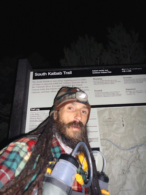
I had started off writing my splits for each time I hit one of the rims on my thigh in blue Sharpie, but it was quickly smeared by sweet and became illegible. So I switched to writing my times on my left calf sleeve, the underneath one that was protected by the Zensah sleeves I was wearing over them. When I completed my third rim to rim to rim, I took a picture of myself by the trailhead sign, wrote my final time on my calf sleeve, and let out a quiet celebratory, "Woo!" Then I hiked to my car, drank three boxes of tepid of soup, and crashed out in the passenger's seat with my pillow and sleeping bag for eight hours of deep, blessed sleep.
Food: 8820 total calories
Tasty Bites Bombay Potatoes 260 calories
Belly Timber Bar Organic Dark Chocolate 2 x 320 calories
PCC Dried Mango Slices 800 calories
PCC Crystallized Ginger 800 calories
Primal Strips Thai Peanut Meatless Vegan Jerky 4 x 75 calories
Globespun Gourmet Thai Wrap 2 x 400 calories
Reeds Ginger Chews 4 x 25 calories
Justin's Classic Almond Butter 16oz jar 2520 calories
Nutiva Coconut Manna 13 oz (not quite a full jar) 2600 calories
Supplements:
Extreme Endurance lactic acid buffer
MAP - Master Amino Acid Pattern amino acid supplement
Garden Of Life Perfect Food RAW green super food
Ibuactin wholistic anti-inflammatory
Nuun electrolyte enhanced drink tabs: 6 servings Kona Cola, 6 servings Lemon Lime
Jet-Alert caffeine pills (I'm not proud of using these, but am listing them in a spirit of full disclosure. There are two things I find especially funny about their slogan, "Fast acting, easy t' take". First is that folksy construct of dropping the 'o' from the word 'to' and replacing it with an apostrophe. It's a grammatical shortcut with which I was previously unfamiliar, and which seems at best to net you zero. Second is the implication that what consumers dislike about competing brands of caffeine pills is that they are prohibitively difficult t' take.)
Gear:
Ultrabag MDS pack, by WAA Ultra Equipment, a european manufacturer. This particular model is designed and branded for the Marathon Des Sables. Includes built in rainproof pack cover and rain shell, as well as two 750ml water bottles
Camelback collapsable 1 liter unbottle
Altra Lone Peak shoes (original version)
Smartwool toesocks
Smartwool neck gaiter
Turtlefur fleece hat
No-name fleece hat bought from a sale bin in a gas station
Swix cross-country ski mitts with REI merino wool liner gloves
Pendleton long sleeve button up wool shirt
Western Mountaineering Hooded Flash Jacket 850+ fill down
Western Mountaineering Flash Pants 850+ fill down
white calf sleeves
Zensah calf sleeves (both sets at the same time)
Altra Zero Drop Footwear provided short sleeve tech shirt
Asics shorts
Salomon brimmed hat without neck drape
Black Diamond Ultra Distance Z-poles trekking poles, custom hybrid 103cm size. Last season and the year before I used a pair of the 110cm poles. I use really short poles because I only use them for climbing and want to carry less weight the rest of the time. I broke one of the 110s about 3 miles from the end of the Double Wonderland, with somewhere in the range of 1500 miles on them. This year I bought a pair of the 100cm poles, the shortest they make. The tip broke off of the left one at the Lumberjack 100 miler, with less than 170 miles on them. Very disappointing, Black Diamond. I couldn't afford a second brand new pair this year, so I combined pieces from the two broken pairs, affixing the slightly longer bottom sections from my 110s onto the new 100s
Black Diamond Spot headlamp. This is another piece of expensive Black Diamond gear that broke scandalously early in its life, just after the Double Wonderland on a run around Mt St Helens on the Loowit Trail. I think of Black Diamond as a top notch mountaineering gear manufacturer and have chosen their gear for backcountry projects for that reason, but that logic has not been born out by my two most recent purchases. I have run two 100 mile races and set one world record with a piece of duct tape to hold the beam at the correct angle
Go Motion Waist Light Kit 100 (100 lumens)
Asio watch with barometric altimeter
Nokia prepaid cell phone, which quit working permanently
Sony Cybershot 14.1 megapixel digital camera (Yes, I'm so old school my phone and my camera and my mp3 player are three separate pieces of gear)
Sony Walkman mp3 players, two of them; one fully charged, the other supposedly fully charged
SPOT transponder
2Toms Sports Shield
3 extra AAA lithium batteries for headlamp or SPOT transponder
Sharpie, blue
Officials times:
Start South Kaibab Trailhead Sat 05/04/20123 8:12 AM
North Kaibab Trailhead (1st) Sat 05/04/2013 3:41 PM
South Kaibab Trailhead (1st) Sun 05/05/2013 1:37 AM
North Kaibab Trailhead (2nd) Sat 05/05/2013 3:18 PM
South Kaibab Trailhead (2nd) Sun 05/06/2013 3:43 AM
North Kaibab Trailhead (3rd) Sat 05/06/2013 5:31 PM
Finish South Kaibab Trailhead (3rd) Sun 05/07/2013 4:22 AM
17:25 for a single unsupported Rim-to-Rim-to-Rim (2 crossings)
43:31 for a double unsupported Rim-to-Rim-to-Rim (4 crossings)
68:10 for a triple unsupported Rim-to-Rim-to-Rim (6 crossings)
I carried all of my calories and gear from the very beginning. I never accessed any sort of resupply or drop bag or food cache, and I politely refused any food offered to me be people on the trail. I also carried all of my trash until the very end. It amounted to only a fist-sized baggie full of wrappers, an empty almond butter jar, and a mostly empty coconut butter jar.
Give Thanks For Life!


